
CVSA
Field Locations
CVSA Home
Spring '18 Ops Guide

Schedule & Scores
Standings
CVSA Cup
Disciplinary Page
Available Players
Calendar/Bulletin Board
Field Locations
Team Information
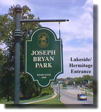
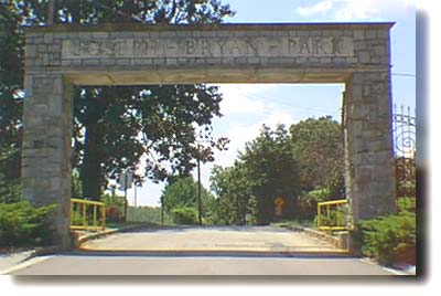
Bryan Park
Treasurer's Page
CVSA Constitution
CVSA Bylaws
Central Virginia Soccer
Referee Association
Insurance Claims
E-Mail the Officers:
PRESIDENT:
Rob Witte
VICE PRESIDENT:
Shawn Shelton
EXEC. SECRETARY:
Liz McAdory
TREASURER:
Jamie Williams
SCHEDULING:
Brian Bartlett
REGISTRAR:
J.R. Fox
PUBLIC RELATIONS:
John Paul Cheski
FIELD MAINTENANCE:
Derek McCown
AT-LARGE:
Andrew Barksdale
Jonathan Blair
Patrick Henry
Jonathon Tolbert
Bruce Williams
Weather Forecasts:
| The Weather
Channel Weather Underground |
Contact CVSA:
P.O. Box 18176
Richmond, VA 23226
TEAM LINKS:
Atlas Soccer Club
Atlas
Titans
A.C. Thunder
Lady Titans
Atlas Coed
Titans Coed
Edo's Squid
Mamma Zû FC
Edo's Squid
Fan Rats
Lions FC
LOKO FC
Metro Sting FC
Partizan Richmond FC
Quilmes AC
Richmond Blaze FC
Richmond City FC
Richmond FC
Screaming Eagles FC
X-Rams
Field Locations
Bryan Park is located in the near northwest side of Richmond where I-64 West and I-95 North
diverge. The main entrance to the park is located on Hermitage Rd. where it crosses I-95.
Travel north on Boulevard (VA 161) across Broad Street and past The Diamond. At Westwood Ave. the Boulevard changes names to Hermitage Rd. Follow Hermitage Rd. north past Laburnum Ave. (A.P. Hill Statue) and the Scottish Rite Temple. As soon as you cross over I-95, the entrance is to your left.
From the West End:
Take I-64 E. Follow I-64 E to I-95 N to Washington. Take the first exit (1/2 mile, exit 80 - Hermitage Rd. / Lakeside Ave. / VA 161). Follow the signs to Hermitage Rd. Take a right and cross over I-95. As soon as you cross over I-95, the entrance is to your left.
From the Southside:
Take Powhite north across the James River to I-195 N. Take I-195 N to I-95 N toward Washington. Take exit 80 (Hermitage Rd. / Lakeside Ave. / VA 161). Follow the signs to Hermitage Rd. Take a right and cross over I-95. As soon as you cross over I-95, the entrance is to your left.
From the East:
Take I-64 W to where I-64 W and I-95N converge, and continue on I-64W/I-95N. As the roads diverge, take I-95 North toward Washington. Take the first exit (1/2 mile, exit 80 - Hermitage Rd. / Lakeside Ave. / VA 161). Follow the signs to Hermitage Rd. Take a right and cross over I-95. As soon as you cross over I-95, the entrance is to your left.
From the North:
Take I-95 S toward Richmond. Use exit 82 (Chamberlayne Ave. / US 301) and continue south on Chamberlayne Ave. Follow Chamberlayne across Azalea Ave. to the next light, Westbrook Ave. Take a right on Westbrook Ave. Follow Westbrook until it dead ends into Hermitage Rd. (VA 161) Take a right on Hermitage Rd. and cross over I-95. As soon as you cross over I-95, the entrance is to your left.
|
FOR USE OF FIELD SE REQUIRE AUTORIZATION PARA EL USO DE LOS CAMPOS DEPORTIVOS |
The field is located in Dorey Park in eastern Henrico County.
From north of the James River, take I-64 E, through downtown, to the Laburnum Ave. exit (exit 195).
Head south on Laburnum, past the Nabisco plant to Darbytown Rd. Turn left, continuing on
Darbytown past Strath Road; the park will be on your right.
From south of the James River, take Chippenham Parkway (VA 150) toward I-95. Upon crossing I-95,
Chippenham will turn into VA 895 (it isn't officially I-895 yet, for all of you road geeks). You will
then confront a $1.50 toll. Soon after, take the first exit, Laburnum Avenue. Follow Laburnum Avenue through
New Market Road (VA 5), and onto to the first major intersection, Darbytown Road. Turn right, continuing on
Darbytown past Strath Road; the park will be on your right.
Fields #3, #4, #5 & #6: Once you enter the park, the fields will be on the right. They are numbered starting
from the road. Field #1, closest to the main road, in known as "The Rugby Field". Field #2 is next, known as "the
Flag Football Field". Fields #3, #4, #5 & #6 are the lit soccer fields that the CVSA will use. They are the last four toward
the wooded area.
Field #7: The CVSA will continue to use the back field, known as Field #7, which is 1/2 mile from the
entrance of the park on the left hand side, just past the equestrian area. For longtime CVSA players,
this is the field that has been in use for the longest by the CVSA.
Glen Allen High School is located north of Richmond in Henrico County.
The surface is field turf.
Park near the tennis courts or in the bus loop on the North side of the school.
The field is located North of Richmond, in Henrico County.
Take I-95 to exit #84B / I-295 toward Charlottesville. Take I-295 to exit #45A / Woodman Road North. Follow Woodman Road to its terminus at Greenwood Road. Turn left on Greenwood Road, travel approximately one mile, and the entrance to the complex will be on the right side of the road.
The surface is field turf.For A Map Click Here.
From the Fan:
Travel north on Boulevard (VA 161) across Broad Street and past The Diamond. At Westwood Ave. the Boulevard changes names to Hermitage Rd. Follow Hermitage Rd. north past Laburnum Ave. (A.P. Hill Statue) and the Scottish Rite Temple. Before you cross over I-95, take a right on Westbrook Avenue. Go through the lights at Brook Road and Chamberlayne Avenue (US 1 / 301). Westbrook will dead end into the field on block later.
From the West End:
Take I-64 E. Follow I-64 E to I-95 N to Washington. Take the first exit (½ mile, exit 80 - Hermitage Rd. / Lakeside Ave. / VA 161). Take a left onto Westbrook Avenue. Go through the lights at Brook Road and Chamberlayne Avenue (US 1 / 301). Westbrook will dead end into the field on block later.
From the Southside:
Take Powhite north across the James River to I-195 N. Take I-195 N to I-95 N toward Washington. Take exit 80 (Hermitage Rd. / Lakeside Ave. / VA 161). Take a left onto Westbrook Avenue. Go through the lights at Brook Road and Chamberlayne Avenue (US 1 / 301). Westbrook will dead end into the field on block later.
From the East:
Take I-64 W to where I-64 W and I-95N converge, and continue on I-64W/I-95N. As the roads diverge, take I-95 North toward Washington. Take the first exit (½ mile, exit 80 - Hermitage Rd. / Lakeside Ave. / VA 161). Take a left onto Westbrook Avenue. Go through the lights at Brook Road and Chamberlayne Avenue (US 1 / 301). Westbrook will dead end into the field on block later.
From the North:
Take I-95 S toward Richmond. Use exit 82 (Chamberlayne Ave. / US 301) and continue south on Chamberlayne Ave. Follow Chamberlayne across Azalea Ave. to the next light, Westbrook Ave. Take a left on Westbrook Avenue, which will dead end into the field one block later.
Henrico High School is located north of Richmond in Henrico County.
The surface is field turf.
The Hensley Soccer Complex is located in the western side of Chesterfield County.
Take Route 360 West (Hull Street Road) from Route 288. Turn left onto N. Spring Run Road at the traffic light. Stay on N. Spring Road Road for 2 miles. Turn right onto Springford Parkway (4-way stop). Travel 1.4 miles on Springford Parkway and turn left onto W. Hensley Road. There are two entrances to the complex off of W. Hensley Rd., on the left. Use the first entrance to reach fields 4-8, and use the second entrance to reach fields 1-3.
Summer 2012: Fields 6-8 are accessed using the FIRST entrance off of W. Hensley Rd, coming from Springford Parkway. Go past the large gravel parking area and bear left. Go over the speed bumps and past the concession stand. Field 6 will be down on the right and Fields 7 and 8 are on the left, over the small bridge.
For A Map Click Here.
Hermitage High School is located northwest of Richmond in Henrico County, near the intersection of Hungary Spring Road and Parham Road.
From the Fan / East of Richmond:
Take I-64 W to exit 185 (Staples Mill Rd. W). Travel west on Staples Mill Rd for 2.6 miles. Turn left onto E Parham Rd. Go 3/4 mile on Parham Rd and turn right onto Hungary Spring Rd. Go 1/4 mile on Hungary Spring Rd and turn right onto Fritz Stadium Drive.
From the West End:
Take I-64 E toward Richmond to exit 181 (Parham Rd.). Turn left onto N Parham Rd. Travel 2.2 miles on Parham Rd and turn left onto Hungary Spring Rd. Go 1/4 mile on Hungary Spring Rd and turn right onto Fritz Stadium Drive.
From the Southside:
Take Powhite north across the James River to I-195 N. Take I-195 N to I-64 W toward Charlottesville. Take I-64 W to exit 185 (Staples Mill Rd. W). Travel west on Staples Mill Rd for 2.6 miles. Turn left onto E Parham Rd. Go 3/4 mile on Parham Rd and turn right onto Hungary Spring Rd. Go 1/4 mile on Hungary Spring Rd and turn right onto Fritz Stadium Drive.
From the North:
Take I-95 S toward Richmond to exit 83B (Parham Rd.) Travel west on E Parham Rd for 4 miles and turn right onto Hungary Spring Rd. Go 1/4 mile on Hungary Spring Rd and turn right onto Fritz Stadium Drive.
J.R. Tucker High School is located north of Richmond in Henrico County.
The surface is field turf.
The complex is located north of the City of Richmond, in Henrico County.
From I-295 (either direction): take Exit 45A to Woodman Road north. Woodman Road ends at Greenwood Road; turn right onto Greenwood Road.
Travel approximately ¾ of a mile, turn left on Francis Rd. and then right into the parking lot.
From I-95 (either direction): take Exit 84B to I-295W toward Charlottesville. The take the first exit, Exit 43B, to US1 / Brook Road north.
Take a left at the first light, Virginia Center Parkway. The take your third left, Francis Road. Francis Road will take you directly to the complex, on the left.
For A Map Click Here.
The field is located in Chesterfied County at Route and Jeff Davis behind Lowe's.
From Downtown, take 95 South to Route 10 West (exit 61B). In 1/2 mile turn left on Route 1/Jefferson Davis Highway. Turn right at the entrance between Lowe's and Rite Aid. Follow the road behind Lowe's and through the gate. Fields are located at the end of the gravel road.
For A Map Click Here.
Heading South on 288: Merge onto VA-288 South. From VA-288 South (17miles) take the VA-76 S exit toward Old Hundred Rd. Merge onto VA-76 W. Turn left at Charter Colony Pkwy/Coalfield Rd/VA-754. Turn left at Genito Rd/VA-604. Make a U-turn. Destination will be on the right.
Heading North on 288: Merge onto VA-288 North. Take the State Route 604 / Courthouse Rd exit. Turn right at Courthouse Rd/State Route 604/VA-604. Turn left at Genito Rd/VA-604. Destination will be on the right
From Points East: Head West on I-64 W toward Richmond. Take exit 200 for I-295 S. toward Rocky Mt NC. Merge onto I-295 S. Take exit 25 to merge onto VA-895 W toward Richmond. Continue onto VA-150 N/Chippenham Pkwy. Take the US-360 W/Hull St Rd ramp to Amelia. Merge onto US-360 W/Hull Street Rd. Turn right at Genito Rd/VA-604. Destination will be on the right
From Points North: Head South on I-95 S toward Exit 86B. Take exit 79 to merge onto I-195 S toward Powhite Pkwy. Continue onto VA-76 W. Turn left at Charter Colony Pkwy/Coalfield Rd/VA-754. Turn left at Genito Rd/VA-604. Make a U-turn. Destination will be on the right.
The surface is field turf.For A Map Click Here.
The field is located between I-195 and Thompson Street, in the Upper Fan District of Richmond. The field is most easily accessible from Patterson Ave.
From the south, take the Powhite Pkwy. to I-195, exiting at the Patterson Ave./Grove Ave. exit. That exit will put you onto Thompson Street, which is one-way. Follow Thompson through the first traffic light (Patterson Ave.). The field will be on your left.
From the north, east, and west, take your local interstate highway (I-95S, I-64W, & I-64E, respectively) to I-195. Take the Broad Street/ Hamilton Street exit. Follow Hamilton Street and turn left at the third light, which is Patterson Ave. Take the next left (Thompson Street); the field is on the left.
Please click here for a complete list of rules for Ukrop Park
The field is located in the southside of the City of Richmond, in the North-Eastern portion of Chesterfield County near the intersecion of Route 10 and Chippenham Parkway.
From the north, south, and east, take I-95, exiting at the Chippenham Parkway (Route 150 North) exit (exit 67). Continue on Chippenham Parkway for 4.1 miles and exit onto Iron Bridge Road (Route 10 East) headed toward Chestrefield. Turn right at the stop light onto Ridgedale Parkway. Conitune on Ridgedale Parkway past J.G. Henning Elementary School and past the Ukrop's Super Market. The entrance to Ukrop Park will be on your right.
From the west, take Chippenham Parkway (Route 150) south towards I-95. Exit onto Iron Bridge Road (Route 10 East) headed toward Chestrefield. Turn right at the stop light onto Ridgedale Parkway. Conitune on Ridgedale Parkway past J.G. Henning Elementary School and past the Ukrop's Super Market. The entrance to Ukrop Park will be on your right.
The surface is field turf.For A Map Click Here.
The field is located on the southeast corner of the University of Richmond campus.
From the Huguenot / Cary Street / River Road area, take River Road west toward Henrico, away from CCV & the River Road Shopping Center. Very quickly you will come upon the UR Drive entrance to the University of Richmond. Take a right and follow UR Drive as it winds through student housing & construction.
After clearing the construction area, look for a parking lot on your right labeled "CHAPEL PARKING". Park there, and there will be an obvious stairway leading to the field.
The surface is field turf.For A Map Click Here.
I-64 E, past downtown, to Exit 195 / Laburnum Avenue.
Follow Laburnum Avenue south, past Williamsburg Road (US60), the railroad overpass, and Darbytown Road (the turnoff for Dorey Park).
After the next light (Willson Road), take your first right, Michael Robinson Way. That road will take you to the football field, where the games are played.
The surface is field turf.|
Post Office Box 18176 Richmond, Virginia 23226 webmaster@cvsasoccer.org https://www.cvsasoccer.org |